Rincon, Puerto Rico Surf Forecast – August 27, 2015
We’re about to get hit with more rain than waves.
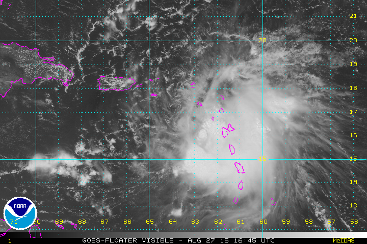
As stated before Erika is a larger and more resilient storm than Danny. I don’t recommend thinking Erika will just be another Danny. There will be some weather tomorrow. I think the southern coasts and the east side of the island will see the worst of it tomorrow and then we’ll get the leftovers on Saturday. Tropical Storm Erika has been forecast to move a little higher north but she seems pretty stubborn and is a little lower latitude than most predicted. The front of the storm has absolutely no rain and weak winds. The back side of the storm is where the action is. Once that side of the storm makes its way to island we’ll see a lot of flooding so be careful. Most of the swell in the ocean right now is east swell and that probably won’t change. The storm was also forecast to be moving along quicker than it is currently moving. This means the whole process of Erika passing over us might be dragged out and for our side of the island the worst weather will be seen after she passes.
Long term outlook:
Tropical Storm Erika is probably going to degenerate into an open wave while passing over Dominican and Hispanola, but she might be enough intact to get going again near the Bahamas. Just north of the Bahamas is our sweet spot for NW tropical swell, but the storm needs a solid wind field in all quadrants. The shear is forecast to be low so if she can get high enough and power up fast enough we could see some NW swell into next week.
Today
NOAA WaveWatch III Wave Model:

Forecast Swell Period:

Forecast Winds:

Fri
NOAA WaveWatch III Wave Model:

Forecast Swell Period:

Forecast Winds:

Sat
NOAA WaveWatch III Wave Model:

Forecast Swell Period:

Forecast Winds:

Sun
NOAA WaveWatch III Wave Model:

Forecast Swell Period:

Forecast Winds:

Mon
NOAA WaveWatch III Wave Model:

Forecast Swell Period:

Forecast Winds:

Tue
NOAA WaveWatch III Wave Model:

Forecast Swell Period:

Forecast Winds:

Wed
NOAA WaveWatch III Wave Model:

Forecast Swell Period:

Forecast Winds:

Thu
NOAA WaveWatch III Wave Model:

Forecast Swell Period:

Forecast Winds:


