Rincon Puerto Rico Surf Forecast – Feb 17, 2016

Another round of swell for surfing Rincon, Puerto Rico.

Another round of swell for surfing Rincon, Puerto Rico.

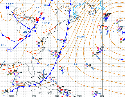
It looks like the super trough is going to pull out into the Atlantic far enough and have a fairly strong high pressure build in behind it. This means we should see some bigger surf this weekend into early next week, but the form might not be perfection. There might be a lot of wind out there in the ocean. Also, as a general rule of thumb, high pressure swell tends to be bumpy and wobbly. Tucked away spots that are protected from the wind should groom it up nicely though.

Here’s how I see the next few days playing out:

Thursday: Small to flat conditions perfect for surf lessons.
Friday: Small to flat conditions possibly too small for even surf lessons.
Saturday: Head high with sets in the 2-3ft overhead range and rough seas and heavy wind.
Sunday: Head high with sets in the 2-3ft overhead range with calmer conditions and lighter wind.
Monday: Probably the best form and longer period swell with offshores at west facing beaches. The surf should still be a couple of feet overhead on sets. There might be a bit of wait between bigger sets as well.
Tuesday: Chest to head high cleaner leftovers with a choppy afternoon.
Wednesday: Knee to waist high surf lessons wave at most exposed breaks.

Today

NOAA WaveWatch III Wave Model:

Wave Watch III from NOAA wave prediction model for surfing Puerto Rico.

Forecast Swell Period:

Forecast Winds:

Fri

NOAA WaveWatch III Wave Model:

Wave Watch III from NOAA wave prediction model for surfing Puerto Rico.

Forecast Swell Period:

Forecast Winds:

Sat

NOAA WaveWatch III Wave Model:

Wave Watch III from NOAA wave prediction model for surfing Puerto Rico.

Forecast Swell Period:

Forecast Winds:

Sun

NOAA WaveWatch III Wave Model:

Wave Watch III from NOAA wave prediction model for surfing Puerto Rico.

Forecast Swell Period:

Forecast Winds:

Mon

NOAA WaveWatch III Wave Model:

Wave Watch III from NOAA wave prediction model for surfing Puerto Rico.

Forecast Swell Period:

Forecast Winds:

Tue

NOAA WaveWatch III Wave Model:

Wave Watch III from NOAA wave prediction model for surfing Puerto Rico.

Forecast Swell Period:

Forecast Winds:

Wed

NOAA WaveWatch III Wave Model:

Wave Watch III from NOAA wave prediction model for surfing Puerto Rico.

Forecast Swell Period:

Forecast Winds:

Thu

NOAA WaveWatch III Wave Model:

Wave Watch III from NOAA wave prediction model for surfing Puerto Rico.

Forecast Swell Period:

Forecast Winds:

Atlantic Ocean Satellite Loop

Using Automated Forecast Tools:

Remember that no matter what a computer model tells you, what you see on the beach might be completely different. That's why i go take pictures of the beach every day. These tools help give an idea of what to expect, but weather prediction is not always exact especially the further out you try to forecast. Surf forecasting takes into account the general correlation between past weather data and resulting surf conditions. Another thing to keep in mind is the difference between actual swell height and the face height of the rideable wave it creates. For example. When the waves are forecast to have a 6ft swell at 13 seconds or higher with a NW angle we normally get waves that most people would call double over-head on sets. Swell angle is also important, especially for shorter period swell (9-11 seconds). For example 3ft at 11 seconds from the NW will make a bigger wave than 4ft at 9 seconds from the NE. Normally longer period swell (13+ seconds) will be more powerful and keep the surf size a little better even if the angle isn't a direct hit to Rincon. Generally any swell less than 9 seconds is super weak here in Rincon unless it has a lot of west in it. Also, most NE swell under 12 seconds is weak and mushy. 2ft at 8 seconds is generally small to flat. ENE swell will almost never make it into Rincon unless it was something like 10ft at 18 seconds from the ENE.