Rincon Puerto Rico Surf Forecast – Oct 5, 2016
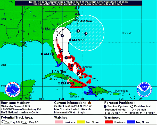
Hurricane Matthew to make another round of surf after wreaking havoc on the East coast of FL.
Hurricane Matthew is still a large and powerful storm. He’s going to take a very very dangerous path for the Bahamas and the East Coast of FL. The shift to the west in his forecast track negatively affects his NW swell generation for us until later in the forecast period. We should still see some background swell in the waist high range over the next few days from his trek across the Bahamas. Late in the forecast period, do you notice that hook and swoop? That is what some top notch NW hurricane swell in the making looks like. That swoop is what it’s all about. Hope for the swoop! Next week could be EPIC if he maintains strength and does the swoop.
Tropical Storm Nicole forecast to drunkenly meander about the ocean – some surf possible.
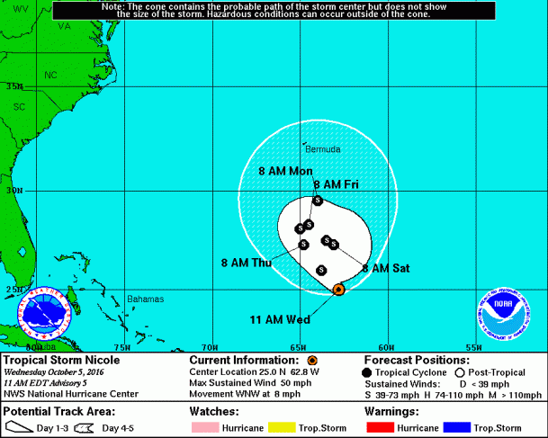
Though not a very large or powerful storm, her motion around the 65W barrier means some smaller surf could make its way to PR. Especially since we should have dead winds or south winds through the weekend, the north coast of Puerto Rico should be fun for the rest of the week and all weekend! Head up to Isabela if Rincon isn’t big enough and you should be able to score some decent waves!
Today
NOAA WaveWatch III Wave Model:

Forecast Swell Period:

Forecast Winds:

Fri
NOAA WaveWatch III Wave Model:

Forecast Swell Period:

Forecast Winds:

Sat
NOAA WaveWatch III Wave Model:

Forecast Swell Period:

Forecast Winds:

Sun
NOAA WaveWatch III Wave Model:

Forecast Swell Period:

Forecast Winds:

Mon
NOAA WaveWatch III Wave Model:

Forecast Swell Period:

Forecast Winds:

Tue
NOAA WaveWatch III Wave Model:

Forecast Swell Period:

Forecast Winds:

Wed
NOAA WaveWatch III Wave Model:

Forecast Swell Period:

Forecast Winds:

Thu
NOAA WaveWatch III Wave Model:

Forecast Swell Period:

Forecast Winds:


