Rincon, Puerto Rico Surf Forecast – March 1, 2016
This is the storm that could be making some waves next week!
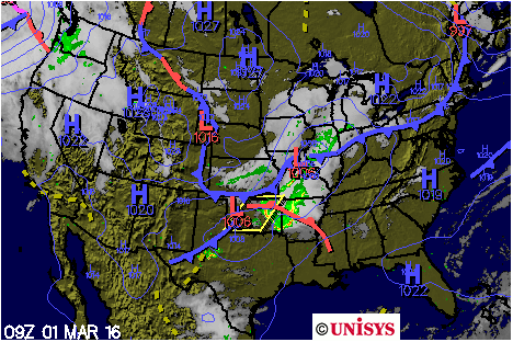
So far Monday and Tuesday seem to be when the models are calling for some swell to show up from the storm above. Bear in mind that we are still several days out and the a lot of things have to happen for this to pan out. If the storm strengthens a bit and pulls off the states sooner, we’ll see some swell sooner. This is what everyone who is doing the contest this weekend and who is involved in throwing the contest is hoping for. If enough people stare at this storm on sat images and mind-will it to strengthen and dip out into the Atlantic early, it just might happen. Seasonally, however, it’s more likely to come in a little later than expected. Plus the models are giving the storm a bit of a higher latitude track which tends to delay swell arrival on account of the swell being generated further away from our island. The period is looking a bit longer with this scenario though. Only time will tell.
Here’s what is currently forecast to happen:
Wednesday – Leftover wind swell in the waist high range with some bigger sets and clean conditions in the morning.
Thursday – Mushy background swell in the knee to waist high range perfect for surf lessons.
Friday – Lake flat in Rincon.
Saturday – Lake flat in Rincon.
Sunday – Lake flat conditions most of the day with some knee high wind chop by the evening.
Monday – Chest to head high and glassy conditions in the morning. Swell will build to a few feet overhead by the end of the day with strong winds as the swell fills in.
Tuesday – 2ft Overhead with some double overhead sets and windy in the afternoon. Find wind blocked spots and surf to your hearts content. The swell period should be decent and provide plenty of power.
Today
NOAA WaveWatch III Wave Model:

Forecast Swell Period:

Forecast Winds:

Sat
NOAA WaveWatch III Wave Model:

Forecast Swell Period:

Forecast Winds:

Sun
NOAA WaveWatch III Wave Model:

Forecast Swell Period:

Forecast Winds:

Mon
NOAA WaveWatch III Wave Model:

Forecast Swell Period:

Forecast Winds:

Tue
NOAA WaveWatch III Wave Model:

Forecast Swell Period:

Forecast Winds:

Wed
NOAA WaveWatch III Wave Model:

Forecast Swell Period:

Forecast Winds:

Thu
NOAA WaveWatch III Wave Model:

Forecast Swell Period:

Forecast Winds:

Fri
NOAA WaveWatch III Wave Model:

Forecast Swell Period:

Forecast Winds:


