Rincon, Puerto Rico Surf Forecast – Sept 14, 2020

Hurricane Paulette Dumping swell for days!

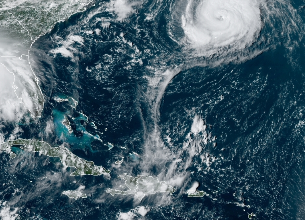
Hurricane Paulette Dumping Swell at Rincon for days!

The storm is intensifying for the next few days and should have at least 3 or 4 days of residual swell from what we’re seeing it do right now. In addition, we should see some heavy extratropical transition and continued swell in the long term. And as if that wasn’t enough, another major storm is supposed to be passing north of Puerto Rico over the weekend right as the final push from Paulette fills in over the weekend. We could very well be surfing for the rest of the month as long as we don’t get destroyed. Which brings us to the final party of this short update – waves keep pulling off Africa and the ocean is hot. Surf yes, but always be prepared in case we have another direct hit on its way.

How good will it get?

Expect most days to be chest to head high here in Rincon at the most exposed breaks. Some days will be bigger and the best days should be a couple feet overhead. The winds are forecast to stay light for most of the week into the weekend. This is really an ideal setup. North coast spots will see many double overhead days. We’re trying to get better about uploading content quicker and through more outlets. THANK YOU TO EVERYONE WHO HAS SUPPORTED US FOR OVER A DECADE NOW!!!!

Today

NOAA WaveWatch III Wave Model:

Wave Watch III from NOAA wave prediction model for surfing Puerto Rico.

Forecast Swell Period:

Forecast Winds:

Sun

NOAA WaveWatch III Wave Model:

Wave Watch III from NOAA wave prediction model for surfing Puerto Rico.

Forecast Swell Period:

Forecast Winds:

Mon

NOAA WaveWatch III Wave Model:

Wave Watch III from NOAA wave prediction model for surfing Puerto Rico.

Forecast Swell Period:

Forecast Winds:

Tue

NOAA WaveWatch III Wave Model:

Wave Watch III from NOAA wave prediction model for surfing Puerto Rico.

Forecast Swell Period:

Forecast Winds:

Wed

NOAA WaveWatch III Wave Model:

Wave Watch III from NOAA wave prediction model for surfing Puerto Rico.

Forecast Swell Period:

Forecast Winds:

Thu

NOAA WaveWatch III Wave Model:

Wave Watch III from NOAA wave prediction model for surfing Puerto Rico.

Forecast Swell Period:

Forecast Winds:

Fri

NOAA WaveWatch III Wave Model:

Wave Watch III from NOAA wave prediction model for surfing Puerto Rico.

Forecast Swell Period:

Forecast Winds:

Sat

NOAA WaveWatch III Wave Model:

Wave Watch III from NOAA wave prediction model for surfing Puerto Rico.

Forecast Swell Period:

Forecast Winds:

National Hurricane Forecast Center
Atlantic Ocean Satellite Loop

Using Automated Forecast Tools:

Remember that no matter what a computer model tells you, what you see on the beach might be completely different. That's why i go take pictures of the beach every day. These tools help give an idea of what to expect, but weather prediction is not always exact especially the further out you try to forecast. Surf forecasting takes into account the general correlation between past weather data and resulting surf conditions. Another thing to keep in mind is the difference between actual swell height and the face height of the rideable wave it creates. For example. When the waves are forecast to have a 6ft swell at 13 seconds or higher with a NW angle we normally get waves that most people would call double over-head on sets. Swell angle is also important, especially for shorter period swell (9-11 seconds). For example 3ft at 11 seconds from the NW will make a bigger wave than 4ft at 9 seconds from the NE. Normally longer period swell (13+ seconds) will be more powerful and keep the surf size a little better even if the angle isn't a direct hit to Rincon. Generally any swell less than 9 seconds is super weak here in Rincon unless it has a lot of west in it. Also, most NE swell under 12 seconds is weak and mushy. 2ft at 8 seconds is generally small to flat. ENE swell will almost never make it into Rincon unless it was something like 10ft at 18 seconds from the ENE.