Rincon, Puerto Rico Surf Forecast – Sept 10, 2020
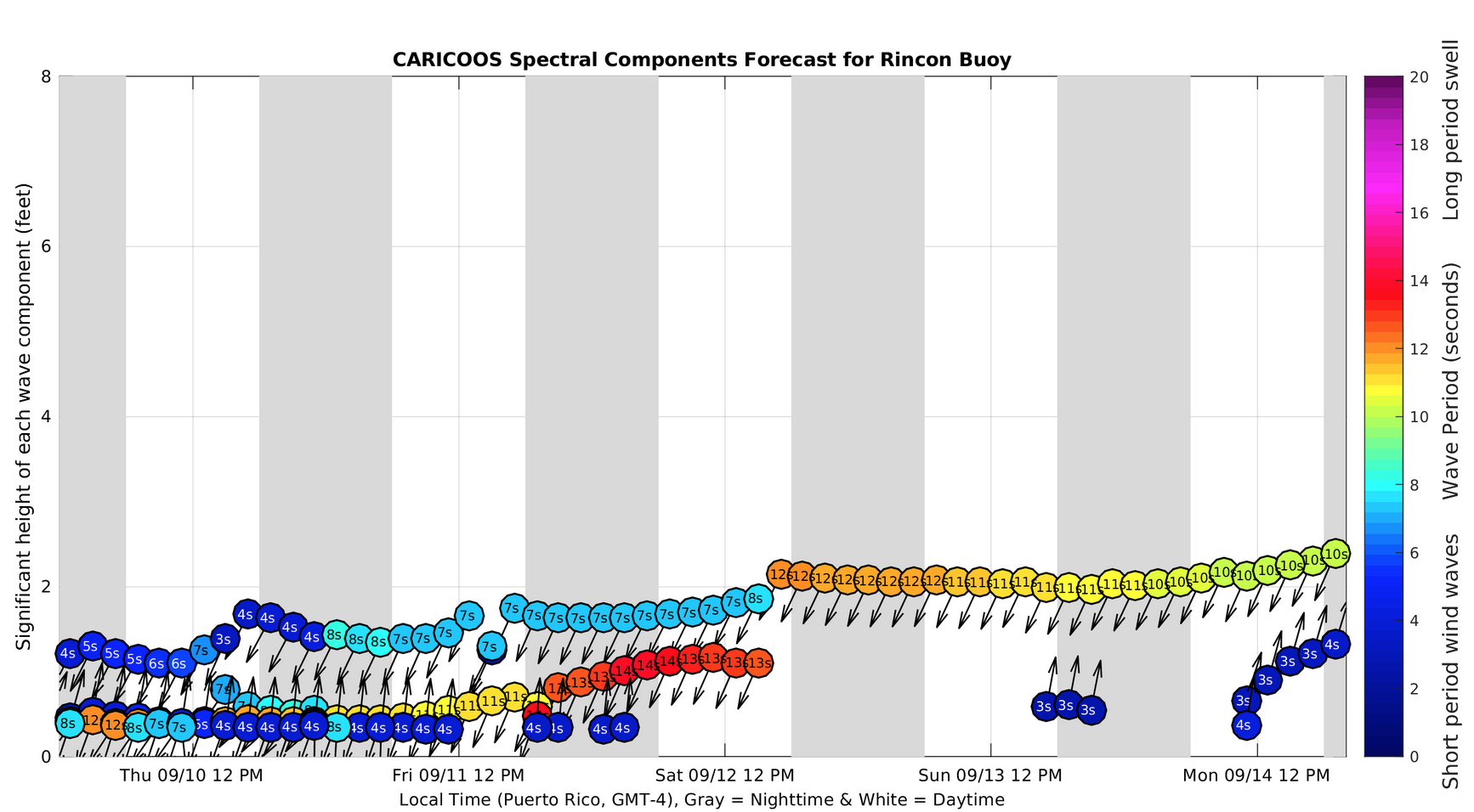
Swell forecast to wrap around into Rincon.
Rincon should see some waist to chest high surf fill in over the weekend. Don’t set your expectations too high though. This event will begin with wrap around swell from the ENE which is less than ideal for Rincon. However, after being flat for so long we’ll take any waves we can get. And if the storm can keep it together as it moves back into our swell window, we could see some of the swell change to NE angle too. The north side of the island should be really fun when the winds are light in the mornings. The size will be head high and bigger up there. Sunday offers a possible opportunity for all north facing beaches to glass off with tropical swell still in the water and south winds. Sundays are now open for surfing after the recent executive order given earlier today. Next week we have more weather to watch and a possible major weather system right on our doorstep. Have fun this weekend!
Here’s what I see happening
Friday: Small waist high mushy lines with a lot of people angry the waves aren’t bigger.
Saturday: Waist to chest high and good form and glassy conditions everywhere in Rincon. Probably a decent wait between sets and a bit mushy due to the angle.
Sunday: Another round of waist high surf. Glassy conditions everywhere in Rincon.
Monday: Another day with south winds and waist high surf building to head high by the end of the day.
Today
NOAA WaveWatch III Wave Model:

Forecast Swell Period:

Forecast Winds:

Sun
NOAA WaveWatch III Wave Model:

Forecast Swell Period:

Forecast Winds:

Mon
NOAA WaveWatch III Wave Model:

Forecast Swell Period:

Forecast Winds:

Tue
NOAA WaveWatch III Wave Model:

Forecast Swell Period:

Forecast Winds:

Wed
NOAA WaveWatch III Wave Model:

Forecast Swell Period:

Forecast Winds:

Thu
NOAA WaveWatch III Wave Model:

Forecast Swell Period:

Forecast Winds:

Fri
NOAA WaveWatch III Wave Model:

Forecast Swell Period:

Forecast Winds:

Sat
NOAA WaveWatch III Wave Model:

Forecast Swell Period:

Forecast Winds:


