Rincon, Puerto Rico Surf Forecast – April 7, 2021

Get ready to surf! Major swell on the way.

Get Ready to Surf – More Swell On the Way!

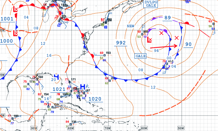
So here we are in April and we’re finally seeing some classic cold-front swell. For once the storm isn’t heading straight for Iceland and Europe and completely avoiding our swell window. I wouldn’t be surprised to see some bigger sets fill in Sunday evening even though Monday is currently the official forecast arrival. Until then, we have some residual swell in the water over the next couple of days. Expect some waist to chest high surf with extremely crowded conditions: people bailing on their boards, falling on top of each other, yelling at each other, dropping in on each other, surf schools everywhere, blue foam boards flying through the air, and countless board collisions. After that fades out we should see some of the bigger swell fill in. Hopefully the crowds will ease, but I get the feeling we’ll just see them increase. Monday will probably see some 2-4ft overhead surf with some possible double overhead sets if all stays on track. I’ll update again over the weekend. Have fun!

Today

NOAA WaveWatch III Wave Model:

Wave Watch III from NOAA wave prediction model for surfing Puerto Rico.

Forecast Swell Period:

Forecast Winds:

Fri

NOAA WaveWatch III Wave Model:

Wave Watch III from NOAA wave prediction model for surfing Puerto Rico.

Forecast Swell Period:

Forecast Winds:

Sat

NOAA WaveWatch III Wave Model:

Wave Watch III from NOAA wave prediction model for surfing Puerto Rico.

Forecast Swell Period:

Forecast Winds:

Sun

NOAA WaveWatch III Wave Model:

Wave Watch III from NOAA wave prediction model for surfing Puerto Rico.

Forecast Swell Period:

Forecast Winds:

Mon

NOAA WaveWatch III Wave Model:

Wave Watch III from NOAA wave prediction model for surfing Puerto Rico.

Forecast Swell Period:

Forecast Winds:

Tue

NOAA WaveWatch III Wave Model:

Wave Watch III from NOAA wave prediction model for surfing Puerto Rico.

Forecast Swell Period:

Forecast Winds:

Wed

NOAA WaveWatch III Wave Model:

Wave Watch III from NOAA wave prediction model for surfing Puerto Rico.

Forecast Swell Period:

Forecast Winds:

Thu

NOAA WaveWatch III Wave Model:

Wave Watch III from NOAA wave prediction model for surfing Puerto Rico.

Forecast Swell Period:

Forecast Winds:

Atlantic Ocean Satellite Loop

Using Automated Forecast Tools:

Remember that no matter what a computer model tells you, what you see on the beach might be completely different. That's why i go take pictures of the beach every day. These tools help give an idea of what to expect, but weather prediction is not always exact especially the further out you try to forecast. Surf forecasting takes into account the general correlation between past weather data and resulting surf conditions. Another thing to keep in mind is the difference between actual swell height and the face height of the rideable wave it creates. For example. When the waves are forecast to have a 6ft swell at 13 seconds or higher with a NW angle we normally get waves that most people would call double over-head on sets. Swell angle is also important, especially for shorter period swell (9-11 seconds). For example 3ft at 11 seconds from the NW will make a bigger wave than 4ft at 9 seconds from the NE. Normally longer period swell (13+ seconds) will be more powerful and keep the surf size a little better even if the angle isn't a direct hit to Rincon. Generally any swell less than 9 seconds is super weak here in Rincon unless it has a lot of west in it. Also, most NE swell under 12 seconds is weak and mushy. 2ft at 8 seconds is generally small to flat. ENE swell will almost never make it into Rincon unless it was something like 10ft at 18 seconds from the ENE.