Rincon Puerto Rico Surf Forecast – Jan 29, 2016
Weaker storm means weaker waves, but the surf should still be fun.
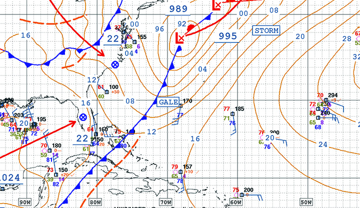
This next cold front doesn’t have as much power as the previous one, and the fetch behind the storm isn’t that strong or lined up at the moment. Most of the strongest winds are ahead of the storm and pushing the bulk of the swell out away from land and out to sea. Basically, even though the satellite presentation of the weather system looks impressive, this will not be a swell anywhere near as awesome as this past week’s swell. Even still, the lower latitude of the storm and the general position of the front should help some NNW swell creep in to Rincon early next week. Here’s how I see it playing out:
Saturday – Small to flat surf perfect for first time surfers, and kids.
Sunday – flat to knee high at best.
Monday – Chest to head high with clean conditions just about everywhere.
Tuesday – Chest to head high with glassy conditions in the morning and heavier winds in the afternoon.
Wednesday – Waist to chest high leftovers glassy in the morning, choppy by late morning and early afternoon.
Thursday – Knee to waist high surf with glassy conditions only in the early morning.
Today
NOAA WaveWatch III Wave Model:

Forecast Swell Period:

Forecast Winds:

Sat
NOAA WaveWatch III Wave Model:

Forecast Swell Period:

Forecast Winds:

Sun
NOAA WaveWatch III Wave Model:

Forecast Swell Period:

Forecast Winds:

Mon
NOAA WaveWatch III Wave Model:

Forecast Swell Period:

Forecast Winds:

Tue
NOAA WaveWatch III Wave Model:

Forecast Swell Period:

Forecast Winds:

Wed
NOAA WaveWatch III Wave Model:

Forecast Swell Period:

Forecast Winds:

Thu
NOAA WaveWatch III Wave Model:

Forecast Swell Period:

Forecast Winds:

Fri
NOAA WaveWatch III Wave Model:

Forecast Swell Period:

Forecast Winds:


