Rincon, Puerto Rico Surf Forecast – July 10, 2018
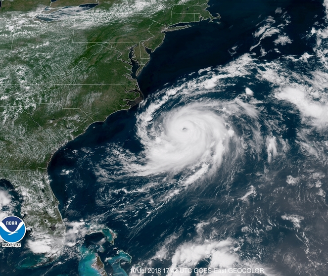
Tropical Storm Chris a wave maker for surfing Rincon, Puerto Rico.
Expect Wednesday and Thursday to be the bulk of the NW swell that we will see from Tropical Storm Chris. I’m seeing some waist high surf with bigger sets. Some background swell might persist afterward but it will be small. If the remnants from Beryl can move far enough away we should see calmer winds instead of onshore flow we’re currently getting and the next few days could be really fun! Chris is looking like he will be quite the extratropical storm once absorbed in a front. I wouldn’t be surprised to see the models pick up on a long period NE swell about a week out. It’s nice to not be completely flat even though we’re in the middle of summer.
Today
NOAA WaveWatch III Wave Model:

Forecast Swell Period:

Forecast Winds:

Sat
NOAA WaveWatch III Wave Model:

Forecast Swell Period:

Forecast Winds:

Sun
NOAA WaveWatch III Wave Model:

Forecast Swell Period:

Forecast Winds:

Mon
NOAA WaveWatch III Wave Model:

Forecast Swell Period:

Forecast Winds:

Tue
NOAA WaveWatch III Wave Model:

Forecast Swell Period:

Forecast Winds:

Wed
NOAA WaveWatch III Wave Model:

Forecast Swell Period:

Forecast Winds:

Thu
NOAA WaveWatch III Wave Model:

Forecast Swell Period:

Forecast Winds:

Fri
NOAA WaveWatch III Wave Model:

Forecast Swell Period:

Forecast Winds:


