Rincon Puerto Rico Surf Forecast – Sept 16, 2016
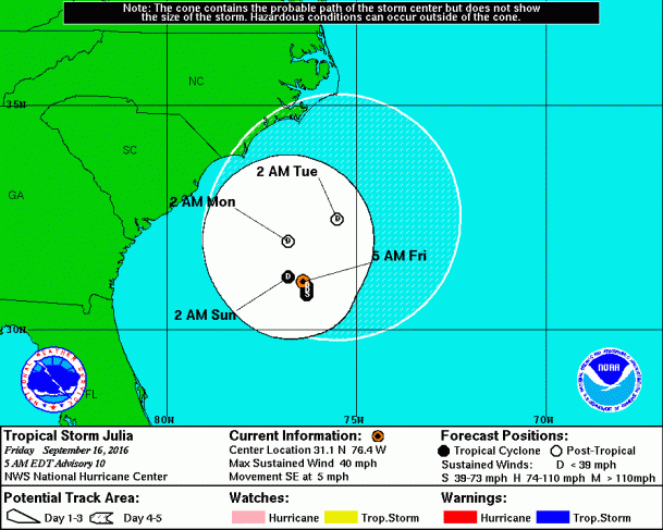
Tropical Storm Julia moves East – this could be a game changer!
She is really close to our NW swell window. If she can muster up some strength during her 5 day walkabout off the coast of the Carolinas we could see some decent swell. She’s not very strong, but she’ll be circling around in a prime spot for NW swell generation. I really hope she can get it together. As long as she stays out to see and gets a bit more organized we could see a NW swell in the next 5 days.
Karl! Good to see you!
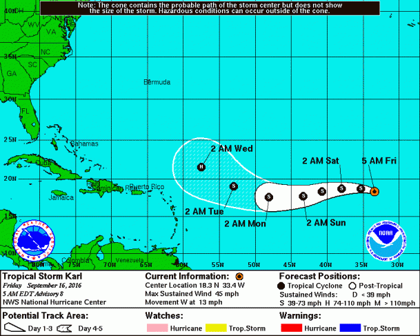
This track is what I was hoping for. I hope he sticks to a westerly route headed our way and then moves north as he approaches the islands and strengthens. 65W to 70W and 25N to 30N would be the ideal target. I’m doubling down on Karl (referred to in previous posts as 95L before he became a named storm). Any swell under this scenario is over a week out so there’s plenty of time for this to go completely wrong, but I have faith in this one.
Today
NOAA WaveWatch III Wave Model:

Forecast Swell Period:

Forecast Winds:

Sun
NOAA WaveWatch III Wave Model:

Forecast Swell Period:

Forecast Winds:

Mon
NOAA WaveWatch III Wave Model:

Forecast Swell Period:

Forecast Winds:

Tue
NOAA WaveWatch III Wave Model:

Forecast Swell Period:

Forecast Winds:

Wed
NOAA WaveWatch III Wave Model:

Forecast Swell Period:

Forecast Winds:

Thu
NOAA WaveWatch III Wave Model:

Forecast Swell Period:

Forecast Winds:

Fri
NOAA WaveWatch III Wave Model:

Forecast Swell Period:

Forecast Winds:

Sat
NOAA WaveWatch III Wave Model:

Forecast Swell Period:

Forecast Winds:


