Rincon Puerto Rico Surf Forecast – Sept 27, 2016
Plenty of weather – will there be surf?
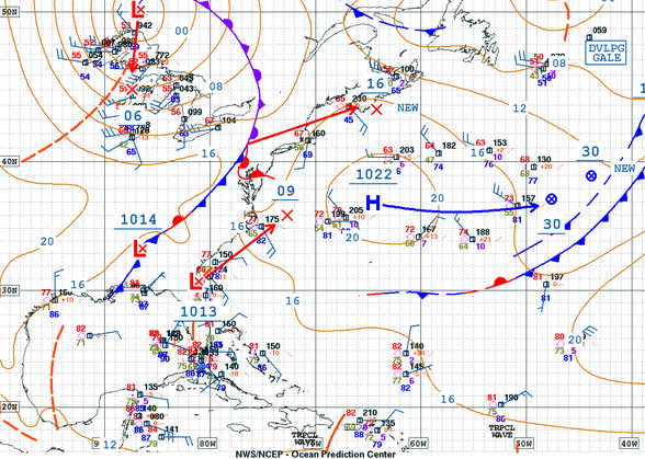
First look at the North Atlantic tells me we should continue to see small short period surf work its way into Rincon over the next few days. Don’t expect anything major, but the high pressure fetch and the approaching weak Low’s coming of the US should continue to bounce back some background swell towards our island. To be honest, I believe this is more important weather to focus on for immediate surf opportunities. All models are being a bit thrown off though on what we will get from the North by focusing on what they all anticipate will happen from the South. I will talk about that next.
Will 97L become a major hurricane and give us a crazy WSW swell?
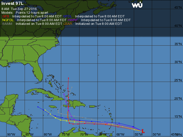
All of the models have been trending on that scenario from about a week ago. I don’t think it will happen. Take a look at the wind shear map below:
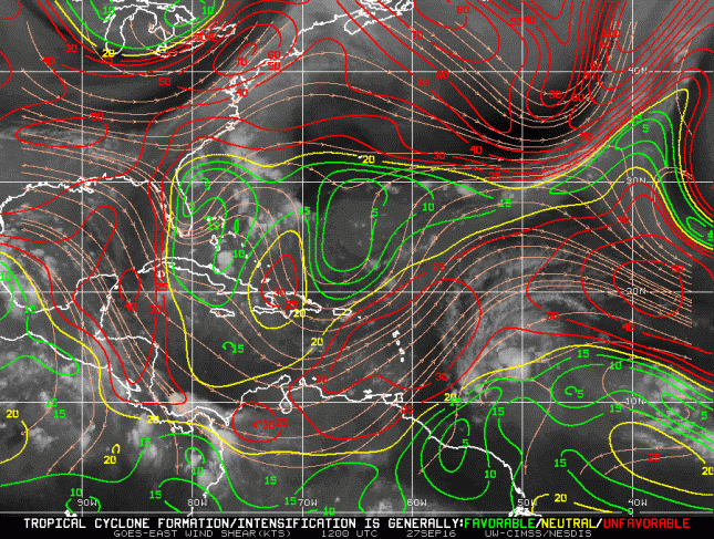
The wind shear right underneath Puerto Rico is enough to kill any developing storm. 97L has only until the end of the day to take advantage of a low shear environment. Granted, there is plenty of heat down there in it’s path and that might help keep the tropical low alive, but if she can’t get her structure together she won’t really be able to feed on that heat effectively.
If you notice in the wind shear map, everything west of Puerto Rico is all peachy as far as wind shear is concerned. This means that after passing to the south of Puerto Rico, if the storm is still in one piece, we could see some real development. All of the models are then calling for a sharp North Turn. This could be the opportunity for surf to come from this system. We’re talking a long ways out, but I like this scenario if it materializes. I’ll get into more detail as to why in my next forecast update after a few more model runs.
Today
NOAA WaveWatch III Wave Model:

Forecast Swell Period:

Forecast Winds:

Sat
NOAA WaveWatch III Wave Model:

Forecast Swell Period:

Forecast Winds:

Sun
NOAA WaveWatch III Wave Model:

Forecast Swell Period:

Forecast Winds:

Mon
NOAA WaveWatch III Wave Model:

Forecast Swell Period:

Forecast Winds:

Tue
NOAA WaveWatch III Wave Model:

Forecast Swell Period:

Forecast Winds:

Wed
NOAA WaveWatch III Wave Model:

Forecast Swell Period:

Forecast Winds:

Thu
NOAA WaveWatch III Wave Model:

Forecast Swell Period:

Forecast Winds:

Fri
NOAA WaveWatch III Wave Model:

Forecast Swell Period:

Forecast Winds:


